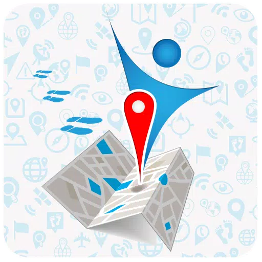
Home > Apps > Travel & Local > OsmAnd — Maps & GPS Offline

Navigating hikes has never been easier. With OsmAnd, an offline world map application based on OpenStreetMap (OSM), you can download maps, add notes, and set off on your adventure without worrying about internet connectivity. OsmAnd takes into account your preferred roads and vehicle dimensions, allowing you to plan routes based on inclines and record GPX tracks seamlessly, all offline.
As an open-source app, OsmAnd respects your privacy. It does not collect user data, and you have full control over the data the app accesses.
Main Features:
Map View
- Customize what appears on your map, including attractions, dining options, health facilities, and more.
- Search for locations using addresses, names, coordinates, or categories.
- Choose from various map styles tailored to different activities, such as touring, nautical, winter and ski, topographic, desert, and off-road.
- Utilize shading relief and plug-in contour lines for a more detailed view.
- Overlay multiple map sources for a comprehensive navigation experience.
GPS Navigation
- Plot routes to your destination without an internet connection.
- Customize navigation profiles for various vehicles, including cars, motorcycles, bicycles, 4x4 vehicles, pedestrians, boats, and public transport.
- Modify routes to avoid specific roads or surfaces.
- Display customizable widgets with route information such as distance, speed, remaining travel time, and distance to the next turn.
Route Planning and Recording
- Create routes point by point using single or multiple navigation profiles.
- Record your journey using GPX tracks.
- Manage GPX tracks by displaying your own or imported tracks on the map and navigating through them.
- View detailed route data, including descents, ascents, and distances.
- Share your GPX tracks on OpenStreetMap.
Creation of Points with Different Functionality
- Add favorites for quick access.
- Set markers to highlight specific points of interest.
- Attach audio and video notes to enrich your maps.
OpenStreetMap Integration
- Contribute to OSM by making edits directly from the app.
- Update maps frequently, up to once per hour.
Additional Features
- Use the compass and radius ruler for precise navigation.
- Access the Mapillary interface for street-level imagery.
- Switch to a night theme for better visibility in low light conditions.
- Explore Wikipedia entries directly from the map.
- Benefit from a large global community, extensive documentation, and dedicated support.
Paid Features:
Maps+ (In-App Purchase or Subscription)
- Support for Android Auto.
- Unlimited map downloads for extensive coverage.
- Access to topo data, including contour lines and terrain information.
- Nautical depth data for marine navigation.
- Offline access to Wikipedia and Wikivoyage travel guides.
OsmAnd Pro (Subscription)
- OsmAnd Cloud for backup and restore across devices.
- Cross-platform compatibility for seamless use across different devices.
- Hourly map updates to keep your maps current.
- Weather plugin for real-time weather updates.
- Elevation widget to monitor altitude changes.
- Customize your route line for personalized navigation.
- Support for external sensors via ANT+ and Bluetooth.
- Online elevation profile for detailed terrain analysis.
Additional Game Information
Latest Version4.8.6 |
Category |
Requires AndroidAndroid 7.0+ |
Available on
|


Top Download
More >


Trending apps
-

- Okuvaryum - Books for Kids
- 4.4 News & Magazines
- Okuvaryum: Digital Reading Platform for Kids!Okuvaryum is the ultimate digital reading platform for kids ages 4 and up. It offers a vast library of educational and entertaining children's books in Turkish, complete with beautiful illustrations and audio narration by voice actors. With new books added every month, Okuvaryum provides a fresh and engaging reading experience that helps children improve their listening, reading comprehension, and social skills.The app features a series format that helps young learners establish
-

- CheckMath
- 4.4 Productivity
- CheckMath: Your AI-Powered Learning Companion CheckMath, a free app leveraging cutting-edge AI and ChatGPT, is designed to revolutionize your learning experience. Need help with math, physics, or chemistry? Simply chat with our AI or snap a photo of your problem – any grade level, any subject. Get
-

- Loop Maker Pro: Dj Beat Maker
- 4 Tools
- Unleash your inner DJ with Loop Maker Pro! Create pro-quality beats and music with DJ loops and pads. Explore rock, EDM, and trap genres. Mix loops and pads for endless possibilities. Record your hits and share them with the world. Learn beat making skills with Loop Maker Academy. Experience the thrill of being a DJ with Loop Maker Pro!
-

-

- Insmate Downloader:Story saver
- 4.5 Tools
- InsMate: Download and Share Instagram Content with EaseInsMate makes downloading and reposting Instagram content a breeze. Effortlessly save videos, photos, stories, and reels to your gallery without logging in. Share IG content with one click, including captions and hashtags. Enjoy offline viewing of stories and high-quality downloads. InsMate's user-friendly interface and reliable service make it the ultimate Instagram companion.
-

- UCOO
- 3.5 Communication
- UCOO, a leading social networking app for Chinese-speaking users, fosters connections and builds communities. Its high-value matching feature pairs users with nearby friends, while the voice party function adds an auditory dimension to digital companionship. Tribal circles connect users based on shared interests and locations, offering both online engagement and in-person meetups. The tag matching system personalizes recommendations, ensuring compatible connections.
Latest APP
-

- Flight Tracker
- 3.0 Travel & Local
- Discover the ultimate tool for tracking airplanes and flights in real-time with our advanced Live Flight Tracker ✈️ and Flight Status App. Whether you're a frequent flyer or waiting to pick up a loved one at the airport, our app transforms your smartphone into a comprehensive flight radar, providing
-

- Palatine Travel Live
- 4.1 Travel & Local
- Introducing the Palatine Travel App, brought to you by Viajes Temixco, the ultimate luxury travel companion designed to streamline your journey. With this cutting-edge app, effortlessly manage the meticulously crafted travel itinerary that your personal advisor has tailored just for you. Say goodbye
-

- Firsty
- 4.7 Travel & Local
- Stay connected around the world with Firsty. By installing the Firsty app, you can get online in minutes, regardless of where your travels take you. Once you download the app, you're automatically connected globally, eliminating the need to switch (e)SIMs as you move from one country to another. Unl
-

- Where is my Train
- 4.8 Travel & Local
- "Where is my Train" is an exceptional train app designed to enhance your travel experience with live train status and up-to-date schedules. Remarkably, this app functions seamlessly offline, without the need for an internet connection or GPS, making it incredibly reliable and convenient for traveler
-

- NoteCam Lite - GPS memo camera
- 3.2 Travel & Local
- Ever snapped a picture and then struggled to remember where it was taken? Or perhaps you've forgotten the person or the specific details about a moment captured in a photo? Enter NoteCam, your solution to these common problems. NoteCam is an innovative camera app that integrates GPS information, inc
-

- Salaat First: Prayer Times
- 5.0 Travel & Local
- Prayer times are calculated accurately, insha'Allah, with the Salaat First app, which uses multiple conventions to ensure precision in determining the timings for your daily prayers.Application Features:• Receive notifications for each prayer with the option to choose from various adhan sounds.• Set
-

- MetroMan China
- 5.0 Travel & Local
- This is China's premier metro app, designed to enhance your travel experience across China's bustling cities.Fully Up-to-Date for 2024Our app provides the most current metro maps and detailed information, ensuring you have the latest data at your fingertips.Route PlannerNavigate with ease using our
-
- OneLocator: Phone Tracker
- 4.7 Travel & Local
- In today's fast-paced world, keeping track of your phones and ensuring the safety of your children is paramount. With Phone Tracker, a highly reliable and precise GPS tracker, you can locate your devices and your kids with ease. Designed to quickly and accurately find your children's location by the
-

- MAPS.ME: Offline maps GPS Nav
- 4.6 Travel & Local
- Discover the world with ease using our comprehensive offline navigation system, complete with detailed maps and precise driving directions. Trusted by over **140 million** travelers globally, our app offers a seamless experience whether you're exploring new cities or navigating familiar roads.Offlin
Breaking News
-

Emoak launches its latest casual puzzle game, now available on mobile platforms
-

No Snooze? You Lose! SF6 Tournament “Sleep Fighter” Requires You to Rest
-

-

Stumble Guys joins hands with My Hero Academia, heroic adventures are waiting for you!
-

Fortnite Re-Releases Paradigm Skin By Accident, Lets Players Keep It Anyways
-
Discover the Ten Dominating Cards in LUDUS: PvP Arena's Battle Royale